Distance from Warsaw to Pastavy
Distance between Warsaw and Pastavy is 500 kilometers (311 miles).
Driving distance from Warsaw to Pastavy is 605 kilometers (376 miles).
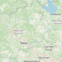
Distance Map Between Warsaw and Pastavy
Warsaw, Poland ↔ Pastavy, Vitebsk, Belarus = 311 miles = 500 km.


How far is it between Warsaw and Pastavy
Warsaw is located in Poland with (52.2298,21.0118) coordinates and Pastavy is located in Belarus with (55.1168,26.8326) coordinates. The calculated flying distance from Warsaw to Pastavy is equal to 311 miles which is equal to 500 km.
If you want to go by car, the driving distance between Warsaw and Pastavy is 605.37 km. If you ride your car with an average speed of 112 kilometers/hour (70 miles/h), travel time will be 05 hours 24 minutes. Please check the avg. speed travel time table on the right for various options.
Difference between fly and go by a car is 105 km.
| City/Place | Latitude and Longitude | GPS Coordinates |
|---|---|---|
| Warsaw | 52.2298, 21.0118 | 52° 13´ 47.1720'' N 21° 0´ 42.4080'' E |
| Pastavy | 55.1168, 26.8326 | 55° 7´ 0.3360'' N 26° 49´ 57.4680'' E |
Estimated Travel Time Between Warsaw and Pastavy
| Average Speed | Travel Time |
|---|---|
| 30 mph (48 km/h) | 12 hours 36 minutes |
| 40 mph (64 km/h) | 09 hours 27 minutes |
| 50 mph (80 km/h) | 07 hours 34 minutes |
| 60 mph (97 km/h) | 06 hours 14 minutes |
| 70 mph (112 km/h) | 05 hours 24 minutes |
| 75 mph (120 km/h) | 05 hours 02 minutes |
Related Distances from Warsaw
| Cities | Distance |
|---|---|
| Warsaw to Minsk | 540 km |
| Warsaw to Brest | 203 km |
| Warsaw to Baranovichi | 417 km |
| Warsaw to Vitebsk | 827 km |
| Warsaw to Gomel | 734 km |