Distance from Wayne to Fords
Distance between Wayne and Fords is 44 kilometers (27 miles).
Driving distance from Wayne to Fords is 55 kilometers (34 miles).
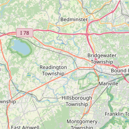
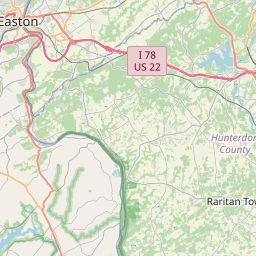
Distance Map Between Wayne and Fords
Wayne, Trenton, United States ↔ Fords, Trenton, United States = 27 miles = 44 km.
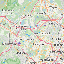
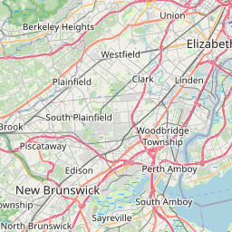

How far is it between Wayne and Fords
Wayne is located in United States with (40.9254,-74.2765) coordinates and Fords is located in United States with (40.5293,-74.316) coordinates. The calculated flying distance from Wayne to Fords is equal to 27 miles which is equal to 44 km.
If you want to go by car, the driving distance between Wayne and Fords is 54.7 km. If you ride your car with an average speed of 112 kilometers/hour (70 miles/h), travel time will be 00 hours 29 minutes. Please check the avg. speed travel time table on the right for various options.
Difference between fly and go by a car is 11 km.
| City/Place | Latitude and Longitude | GPS Coordinates |
|---|---|---|
| Wayne | 40.9254, -74.2765 | 40° 55´ 31.3680'' N 74° 16´ 35.5440'' W |
| Fords | 40.5293, -74.316 | 40° 31´ 45.3720'' N 74° 18´ 57.5280'' W |
Estimated Travel Time Between Wayne and Fords
| Average Speed | Travel Time |
|---|---|
| 30 mph (48 km/h) | 01 hours 08 minutes |
| 40 mph (64 km/h) | 00 hours 51 minutes |
| 50 mph (80 km/h) | 00 hours 41 minutes |
| 60 mph (97 km/h) | 00 hours 33 minutes |
| 70 mph (112 km/h) | 00 hours 29 minutes |
| 75 mph (120 km/h) | 00 hours 27 minutes |
Related Distances from Wayne
| Cities | Distance |
|---|---|
| Wayne to Parsippany | 24 km |
| Wayne to Paramus | 27 km |
| Wayne to Montclair | 16 km |
| Wayne to Point Pleasant | 115 km |
| Wayne to Livingston 2 | 23 km |
Related Distances to Fords
| Cities | Distance |
|---|---|
| Piscataway to Fords | 8 km |
| Perth Amboy to Fords | 6 km |
| North Bergen to Fords | 45 km |
| Somerset to Fords | 21 km |
| Lakewood 4 to Fords | 66 km |