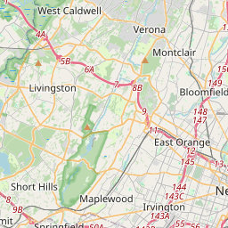
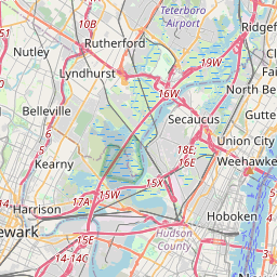
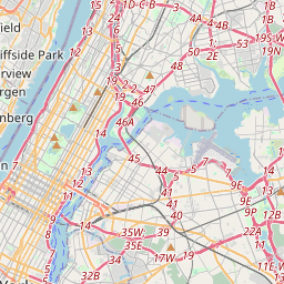
Distance from Wayne to Maplewood
Distance between Wayne and Maplewood is 22 kilometers (13 miles).
Driving distance from Wayne to Maplewood is 37 kilometers (23 miles).
Distance Map Between Wayne and Maplewood
Wayne, Trenton, United States ↔ Maplewood, Trenton, United States = 13 miles = 22 km.


How far is it between Wayne and Maplewood
Wayne is located in United States with (40.9254,-74.2765) coordinates and Maplewood is located in United States with (40.7312,-74.2735) coordinates. The calculated flying distance from Wayne to Maplewood is equal to 13 miles which is equal to 22 km.
If you want to go by car, the driving distance between Wayne and Maplewood is 36.83 km. If you ride your car with an average speed of 112 kilometers/hour (70 miles/h), travel time will be 00 hours 19 minutes. Please check the avg. speed travel time table on the right for various options.
Difference between fly and go by a car is 15 km.
| City/Place | Latitude and Longitude | GPS Coordinates |
|---|---|---|
| Wayne | 40.9254, -74.2765 | 40° 55´ 31.3680'' N 74° 16´ 35.5440'' W |
| Maplewood | 40.7312, -74.2735 | 40° 43´ 52.3560'' N 74° 16´ 24.5280'' W |
Estimated Travel Time Between Wayne and Maplewood
| Average Speed | Travel Time |
|---|---|
| 30 mph (48 km/h) | 00 hours 46 minutes |
| 40 mph (64 km/h) | 00 hours 34 minutes |
| 50 mph (80 km/h) | 00 hours 27 minutes |
| 60 mph (97 km/h) | 00 hours 22 minutes |
| 70 mph (112 km/h) | 00 hours 19 minutes |
| 75 mph (120 km/h) | 00 hours 18 minutes |
Related Distances from Wayne
| Cities | Distance |
|---|---|
| Wayne to Asbury Park | 103 km |
| Wayne to Atlantic City | 215 km |
| Wayne to Avenel | 56 km |
| Wayne to Bayonne | 45 km |
| Wayne to Belleville 3 | 23 km |
| Wayne to Bergenfield | 32 km |
| Wayne to Bloomfield | 21 km |
| Wayne to Bridgeton | 221 km |
| Wayne to Camden | 169 km |
| Wayne to Carteret | 53 km |
Related Distances to Maplewood
| Cities | Distance |
|---|---|
| Morristown 2 to Maplewood 2 | 25 km |
| South Orange to Maplewood 2 | 3 km |
| Union to Maplewood 2 | 6 km |
| Union City 2 to Maplewood 2 | 30 km |
| Paramus to Maplewood 2 | 40 km |
| North Bergen to Maplewood 2 | 33 km |
| Rahway to Maplewood 2 | 21 km |
| Perth Amboy to Maplewood 2 | 35 km |
| Nutley to Maplewood 2 | 23 km |
| Newark to Maplewood 2 | 15 km |