Distance from Wilson to Boone
Distance between Wilson and Boone is 343 kilometers (213 miles).
Driving distance from Wilson to Boone is 381 kilometers (237 miles).
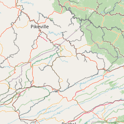
Distance Map Between Wilson and Boone
Wilson, Raleigh, United States ↔ Boone, Raleigh, United States = 213 miles = 343 km.


How far is it between Wilson and Boone
Wilson is located in United States with (35.7213,-77.9155) coordinates and Boone is located in United States with (36.2168,-81.6746) coordinates. The calculated flying distance from Wilson to Boone is equal to 213 miles which is equal to 343 km.
If you want to go by car, the driving distance between Wilson and Boone is 381.12 km. If you ride your car with an average speed of 112 kilometers/hour (70 miles/h), travel time will be 03 hours 24 minutes. Please check the avg. speed travel time table on the right for various options.
Difference between fly and go by a car is 38 km.
| City/Place | Latitude and Longitude | GPS Coordinates |
|---|---|---|
| Wilson | 35.7213, -77.9155 | 35° 43´ 16.5720'' N 77° 54´ 55.9440'' W |
| Boone | 36.2168, -81.6746 | 36° 13´ 0.4440'' N 81° 40´ 28.3800'' W |
Estimated Travel Time Between Wilson and Boone
| Average Speed | Travel Time |
|---|---|
| 30 mph (48 km/h) | 07 hours 56 minutes |
| 40 mph (64 km/h) | 05 hours 57 minutes |
| 50 mph (80 km/h) | 04 hours 45 minutes |
| 60 mph (97 km/h) | 03 hours 55 minutes |
| 70 mph (112 km/h) | 03 hours 24 minutes |
| 75 mph (120 km/h) | 03 hours 10 minutes |
Related Distances from Wilson
| Cities | Distance |
|---|---|
| Wilson to Greenville | 59 km |
| Wilson to Fayetteville | 122 km |
| Wilson to Fuquay Varina | 105 km |
| Wilson to Wake Forest | 71 km |
| Wilson to Rocky Mount | 31 km |
Related Distances to Boone
| Cities | Distance |
|---|---|
| Winston Salem to Boone | 139 km |
| Asheville to Boone | 136 km |
| Charlotte to Boone | 188 km |
| Hickory to Boone | 72 km |
| Morganton to Boone | 68 km |