Distance from Windsor to Sarnia
Distance between Windsor and Sarnia is 91 kilometers (56 miles).
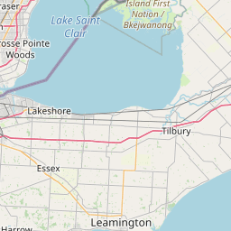
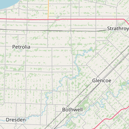
Driving distance from Windsor to Sarnia is 109 kilometers (68 miles).
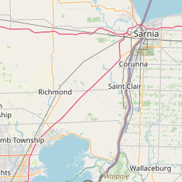
Distance Map Between Windsor and Sarnia
Windsor, Ontario, Canada ↔ Sarnia, Ontario, Canada = 56 miles = 91 km.


How far is it between Windsor and Sarnia
Windsor is located in Canada with (42.3001,-83.0165) coordinates and Sarnia is located in Canada with (42.9787,-82.4041) coordinates. The calculated flying distance from Windsor to Sarnia is equal to 56 miles which is equal to 91 km.
If you want to go by car, the driving distance between Windsor and Sarnia is 109.24 km. If you ride your car with an average speed of 112 kilometers/hour (70 miles/h), travel time will be 00 hours 58 minutes. Please check the avg. speed travel time table on the right for various options.
Difference between fly and go by a car is 18 km.
| City/Place | Latitude and Longitude | GPS Coordinates |
|---|---|---|
| Windsor | 42.3001, -83.0165 | 42° 18´ 0.2880'' N 83° 0´ 59.5440'' W |
| Sarnia | 42.9787, -82.4041 | 42° 58´ 43.1760'' N 82° 24´ 14.6520'' W |
Estimated Travel Time Between Windsor and Sarnia
| Average Speed | Travel Time |
|---|---|
| 30 mph (48 km/h) | 02 hours 16 minutes |
| 40 mph (64 km/h) | 01 hours 42 minutes |
| 50 mph (80 km/h) | 01 hours 21 minutes |
| 60 mph (97 km/h) | 01 hours 07 minutes |
| 70 mph (112 km/h) | 00 hours 58 minutes |
| 75 mph (120 km/h) | 00 hours 54 minutes |
Related Distances from Windsor
| Cities | Distance |
|---|---|
| Windsor to Toronto | 366 km |
| Windsor to London 2 | 193 km |
| Windsor to Sarnia | 109 km |
| Windsor to Brampton | 342 km |
| Windsor to Niagara Falls | 378 km |
Related Distances to Sarnia
| Cities | Distance |
|---|---|
| Windsor to Sarnia | 109 km |
| Toronto to Sarnia | 288 km |
| Sault Ste Marie to Sarnia | 566 km |
| Thunder Bay to Sarnia | 1270 km |
| St Thomas to Sarnia | 115 km |