Distance from Worcester to Mount Pearl
Distance between Worcester and Mount Pearl is 1603 kilometers (996 miles).
Driving distance from Worcester to Mount Pearl is 2395 kilometers (1488 miles).
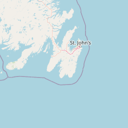
Distance Map Between Worcester and Mount Pearl
Worcester, Boston, United States ↔ Mount Pearl, St. John's, Canada = 996 miles = 1603 km.


How far is it between Worcester and Mount Pearl
Worcester is located in United States with (42.2626,-71.8023) coordinates and Mount Pearl is located in Canada with (47.5166,-52.7814) coordinates. The calculated flying distance from Worcester to Mount Pearl is equal to 996 miles which is equal to 1603 km.
If you want to go by car, the driving distance between Worcester and Mount Pearl is 2395.25 km. If you ride your car with an average speed of 112 kilometers/hour (70 miles/h), travel time will be 21 hours 23 minutes. Please check the avg. speed travel time table on the right for various options.
Difference between fly and go by a car is 792 km.
| City/Place | Latitude and Longitude | GPS Coordinates |
|---|---|---|
| Worcester | 42.2626, -71.8023 | 42° 15´ 45.3240'' N 71° 48´ 8.2440'' W |
| Mount Pearl | 47.5166, -52.7814 | 47° 30´ 59.7240'' N 52° 46´ 52.8600'' W |
Estimated Travel Time Between Worcester and Mount Pearl
| Average Speed | Travel Time |
|---|---|
| 30 mph (48 km/h) | 49 hours 54 minutes |
| 40 mph (64 km/h) | 37 hours 25 minutes |
| 50 mph (80 km/h) | 29 hours 56 minutes |
| 60 mph (97 km/h) | 24 hours 41 minutes |
| 70 mph (112 km/h) | 21 hours 23 minutes |
| 75 mph (120 km/h) | 19 hours 57 minutes |
Related Distances from Worcester
| Cities | Distance |
|---|---|
| Worcester to Toronto | 833 km |
| Worcester to Montreal | 532 km |
| Worcester to Quebec | 673 km |
| Worcester to Ottawa | 661 km |
| Worcester to Hamilton | 766 km |
Related Distances to Mount Pearl
| Cities | Distance |
|---|---|
| Boston to Mount Pearl | 2346 km |
| Quincy to Mount Pearl | 2361 km |
| New Bedford to Mount Pearl | 2035 km |
| Providence to Mount Pearl | 2435 km |
| Worcester to Mount Pearl | 2395 km |