Distance from Yantai to Zoucheng
Distance between Yantai and Zoucheng is 462 kilometers (287 miles).
Distance Map Between Yantai and Zoucheng
Yantai, Jinan, China ↔ Zoucheng, Jinan, China = 287 miles = 462 km.

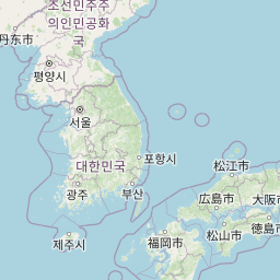

Leaflet | © OpenStreetMap
How far is it between Yantai and Zoucheng
Yantai is located in China with (37.4765,121.4408) coordinates and Zoucheng is located in China with (35.4006,116.9656) coordinates. The calculated flying distance from Yantai to Zoucheng is equal to 287 miles which is equal to 462 km.
| City/Place | Latitude and Longitude | GPS Coordinates |
|---|---|---|
| Yantai | 37.4765, 121.4408 | 37° 28´ 35.3640'' N 121° 26´ 26.9160'' E |
| Zoucheng | 35.4006, 116.9656 | 35° 24´ 2.0160'' N 116° 57´ 56.0160'' E |
Yantai, Jinan, China
Related Distances from Yantai
| Cities | Distance |
|---|---|
| Yantai to Zibo | 361 km |
| Yantai to Qingzhou | 326 km |
| Yantai to Yanzhou | 608 km |
| Yantai to Yatou | 116 km |
| Yantai to Zaozhuang | 579 km |
Zoucheng, Jinan, China
Related Distances to Zoucheng
| Cities | Distance |
|---|---|
| Qufu to Zoucheng | 24 km |
| Qingdao to Zoucheng | 414 km |
| Shouguang to Zoucheng | 323 km |
| Linyi to Zoucheng | 183 km |
| Dongcun to Zoucheng | 522 km |