Distance from Yarmouth to Peabody
Distance between Yarmouth and Peabody is 108 kilometers (67 miles).
Driving distance from Yarmouth to Peabody is 157 kilometers (97 miles).
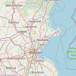
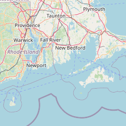
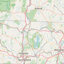
Distance Map Between Yarmouth and Peabody
Yarmouth, Boston, United States ↔ Peabody, Boston, United States = 67 miles = 108 km.


How far is it between Yarmouth and Peabody
Yarmouth is located in United States with (41.7057,-70.2286) coordinates and Peabody is located in United States with (42.5279,-70.9287) coordinates. The calculated flying distance from Yarmouth to Peabody is equal to 67 miles which is equal to 108 km.
If you want to go by car, the driving distance between Yarmouth and Peabody is 156.57 km. If you ride your car with an average speed of 112 kilometers/hour (70 miles/h), travel time will be 01 hours 23 minutes. Please check the avg. speed travel time table on the right for various options.
Difference between fly and go by a car is 49 km.
| City/Place | Latitude and Longitude | GPS Coordinates |
|---|---|---|
| Yarmouth | 41.7057, -70.2286 | 41° 42´ 20.4120'' N 70° 13´ 43.0680'' W |
| Peabody | 42.5279, -70.9287 | 42° 31´ 40.3320'' N 70° 55´ 43.1760'' W |
Estimated Travel Time Between Yarmouth and Peabody
| Average Speed | Travel Time |
|---|---|
| 30 mph (48 km/h) | 03 hours 15 minutes |
| 40 mph (64 km/h) | 02 hours 26 minutes |
| 50 mph (80 km/h) | 01 hours 57 minutes |
| 60 mph (97 km/h) | 01 hours 36 minutes |
| 70 mph (112 km/h) | 01 hours 23 minutes |
| 75 mph (120 km/h) | 01 hours 18 minutes |
Related Distances from Yarmouth
| Cities | Distance |
|---|---|
| Yarmouth to Weymouth | 100 km |
| Yarmouth to South Boston | 116 km |
| Yarmouth to Barnstable | 6 km |
| Yarmouth to Amesbury | 184 km |
| Yarmouth to Lexington 2 | 149 km |
Related Distances to Peabody
| Cities | Distance |
|---|---|
| Reading 3 to Peabody | 15 km |
| Salem 3 to Peabody | 4 km |
| Woburn to Peabody | 24 km |
| Waltham to Peabody | 42 km |
| Saugus to Peabody | 15 km |