Distance from Yoichi to Rumoi
Distance between Yoichi and Rumoi is 107 kilometers (67 miles).
Driving distance from Yoichi to Rumoi is 207 kilometers (129 miles).
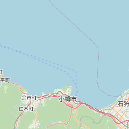
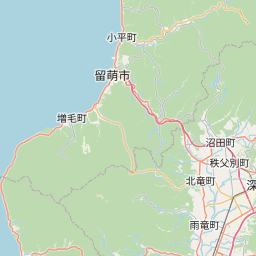
Distance Map Between Yoichi and Rumoi
Yoichi, Sapporo, Japan ↔ Rumoi, Sapporo, Japan = 67 miles = 107 km.


How far is it between Yoichi and Rumoi
Yoichi is located in Japan with (43.2039,140.7703) coordinates and Rumoi is located in Japan with (43.9344,141.6428) coordinates. The calculated flying distance from Yoichi to Rumoi is equal to 67 miles which is equal to 107 km.
If you want to go by car, the driving distance between Yoichi and Rumoi is 207.15 km. If you ride your car with an average speed of 112 kilometers/hour (70 miles/h), travel time will be 01 hours 50 minutes. Please check the avg. speed travel time table on the right for various options.
Difference between fly and go by a car is 100 km.
| City/Place | Latitude and Longitude | GPS Coordinates |
|---|---|---|
| Yoichi | 43.2039, 140.7703 | 43° 12´ 14.0040'' N 140° 46´ 13.0080'' E |
| Rumoi | 43.9344, 141.6428 | 43° 56´ 3.9840'' N 141° 38´ 34.0080'' E |
Estimated Travel Time Between Yoichi and Rumoi
| Average Speed | Travel Time |
|---|---|
| 30 mph (48 km/h) | 04 hours 18 minutes |
| 40 mph (64 km/h) | 03 hours 14 minutes |
| 50 mph (80 km/h) | 02 hours 35 minutes |
| 60 mph (97 km/h) | 02 hours 08 minutes |
| 70 mph (112 km/h) | 01 hours 50 minutes |
| 75 mph (120 km/h) | 01 hours 43 minutes |
Related Distances from Yoichi
| Cities | Distance |
|---|---|
| Yoichi to Otaru | 23 km |
| Yoichi to Shimo Furano | 169 km |
| Yoichi to Tomakomai | 124 km |
| Yoichi to Obihiro | 255 km |
| Yoichi to Shizunai Furukawacho | 190 km |
Related Distances to Rumoi
| Cities | Distance |
|---|---|
| Otaru to Rumoi | 185 km |
| Iwamizawa to Rumoi | 116 km |
| Asahikawa to Rumoi | 90 km |
| Obihiro to Rumoi | 239 km |
| Nemuro to Rumoi | 442 km |